


La Ruta Puuc (the Puuc Route, “puuc“ in Maya meaning hills or mounds) in the Yucatán jungle packs a lot of adventure into one day, as there are major Mayan cities, temples and pyramids every few kilometres. Our trusty driver, José Luis, picked us up from the casa at 8.30am, negotiated the downtown traffic, and within half an hour we were barrelling out of town heading for the Campeche border, jungle all around us, taking around an hour and half to reach the Puuc hills.
Having previously been to the wonderous Uxmal, we decided to explore four sites further along the Ruta Puuc – Kabah, Sayil, Xlapak and Labná. This area of the Yucatán is not-surprisingly rather hilly (hence the Puuc name) with endless folds of dense green jungle, making the road unfurl like an undulating ribbon stretching out to the horizon with the occasional ‘Jaguar Crossing’ sign – and no traffic I might add. From the road the sites are all hidden from view, except for the first one, Kabah, which sprawls to either side of it. But more on the sites later.
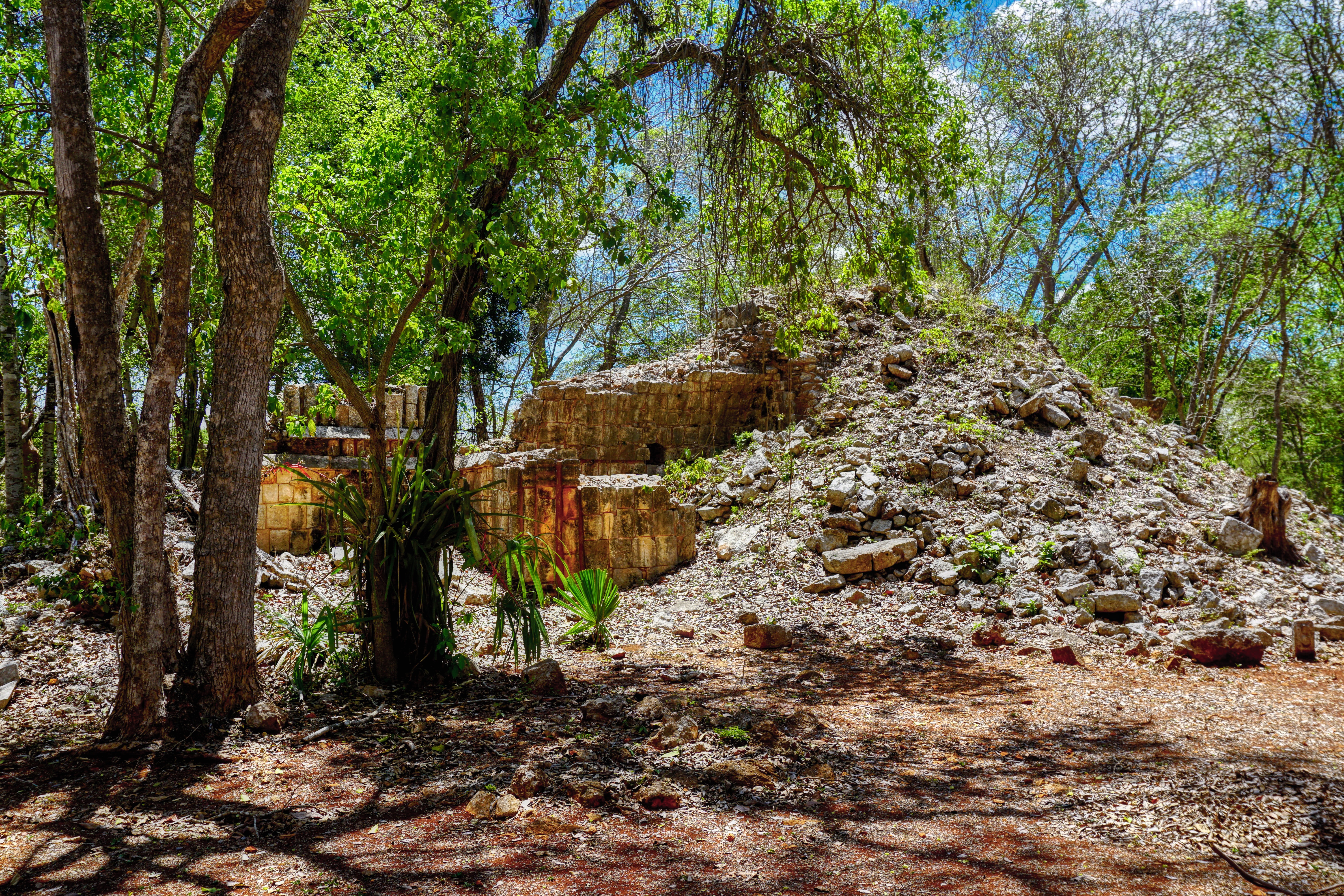
These wonderous places have been here for thousands of years, some as early as the 3rd century BC, but most of what’s standing dates from between the 8th and 11th centuries. Some, if not all, of these settlements were either abandoned or destroyed well before the arrival of the Conquistadores in the early 16th Century, so they remained largely undisturbed, unexplored and lost to the jungle right up until the mid-19th Century when our previously mentioned intrepid explorers, Messers Stephens and Catherwood, followed ancient rumours to become the first Europeans (Stephens actually was American) to see these crumbling ruins.
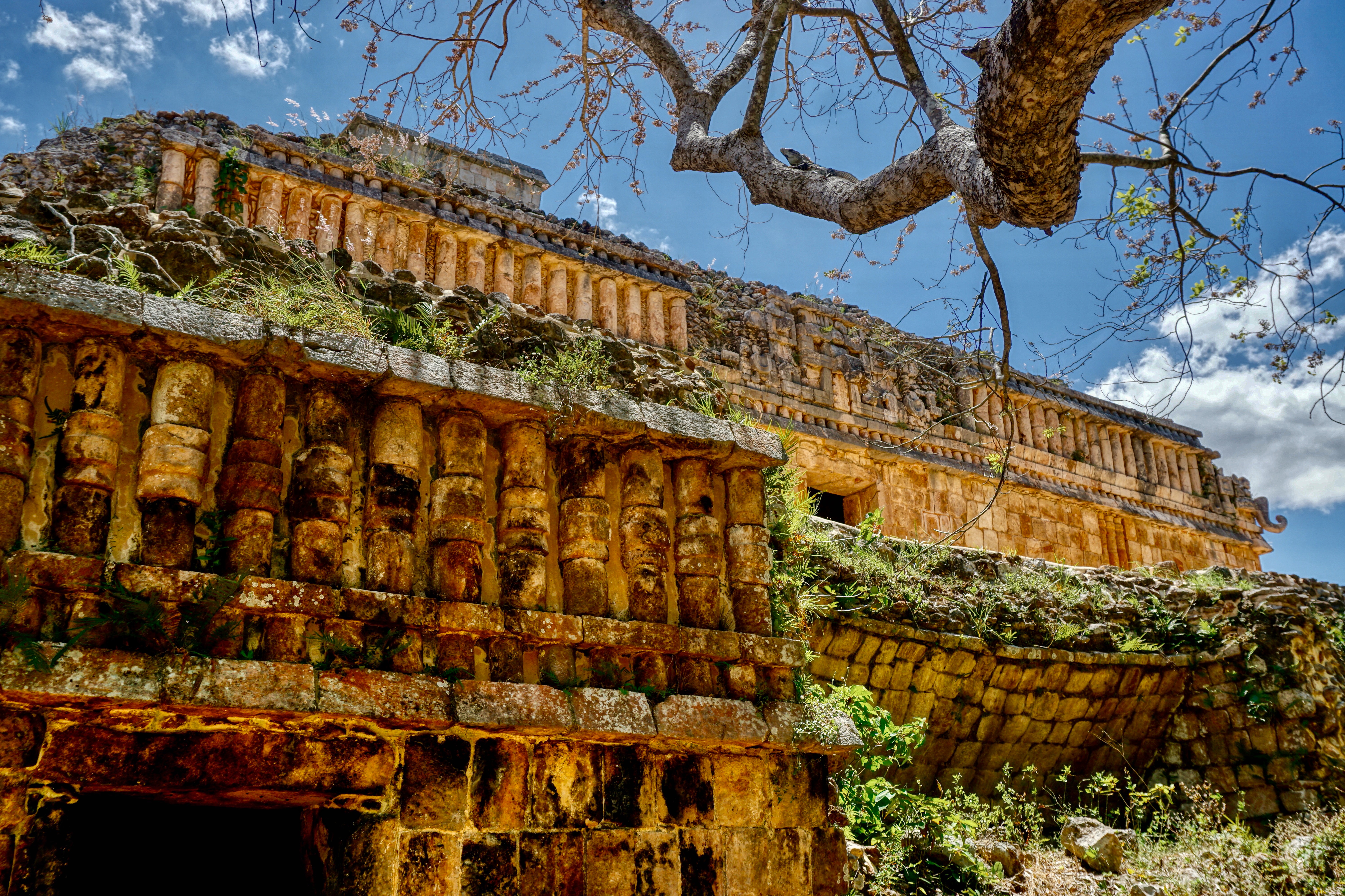
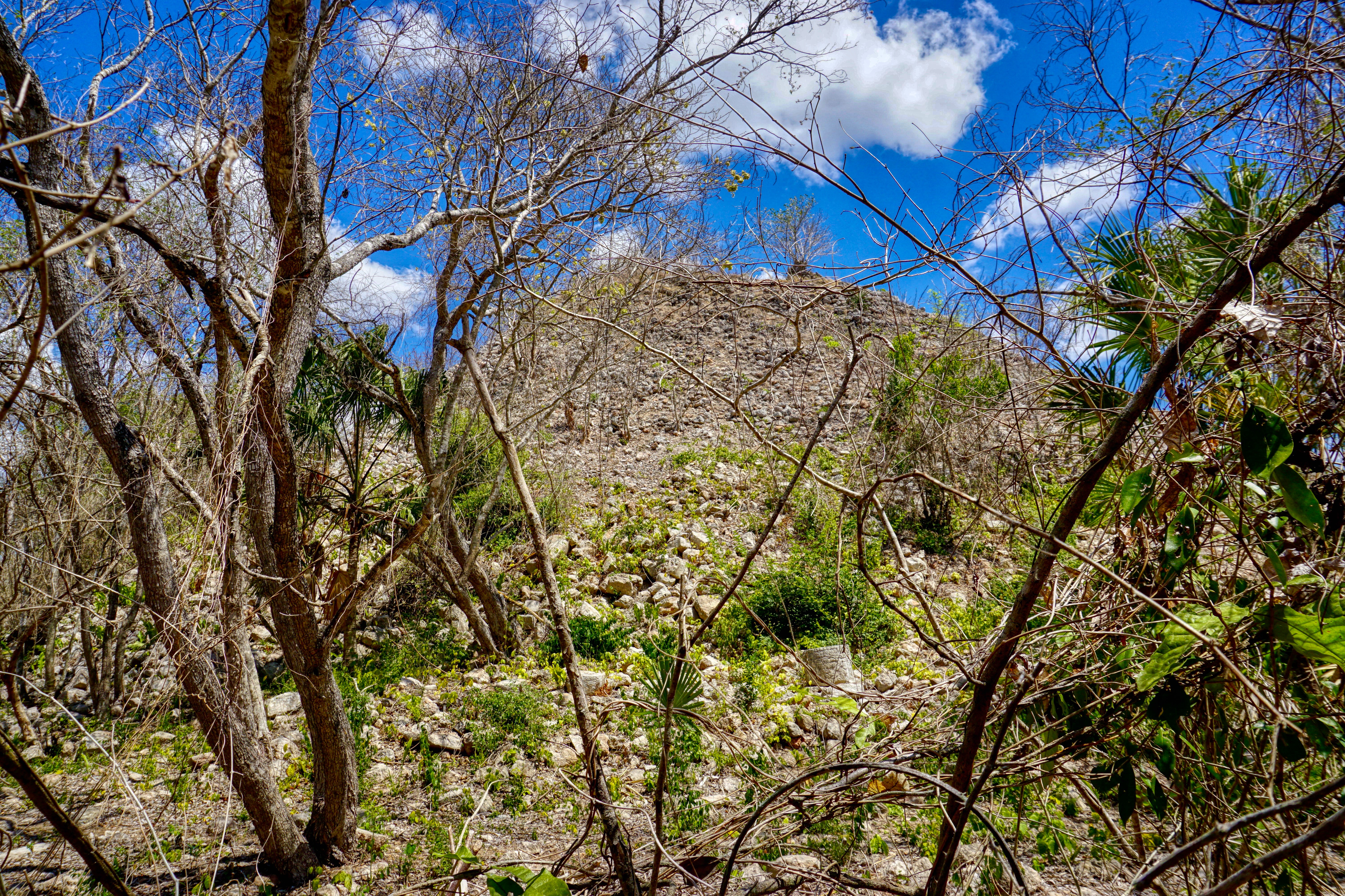
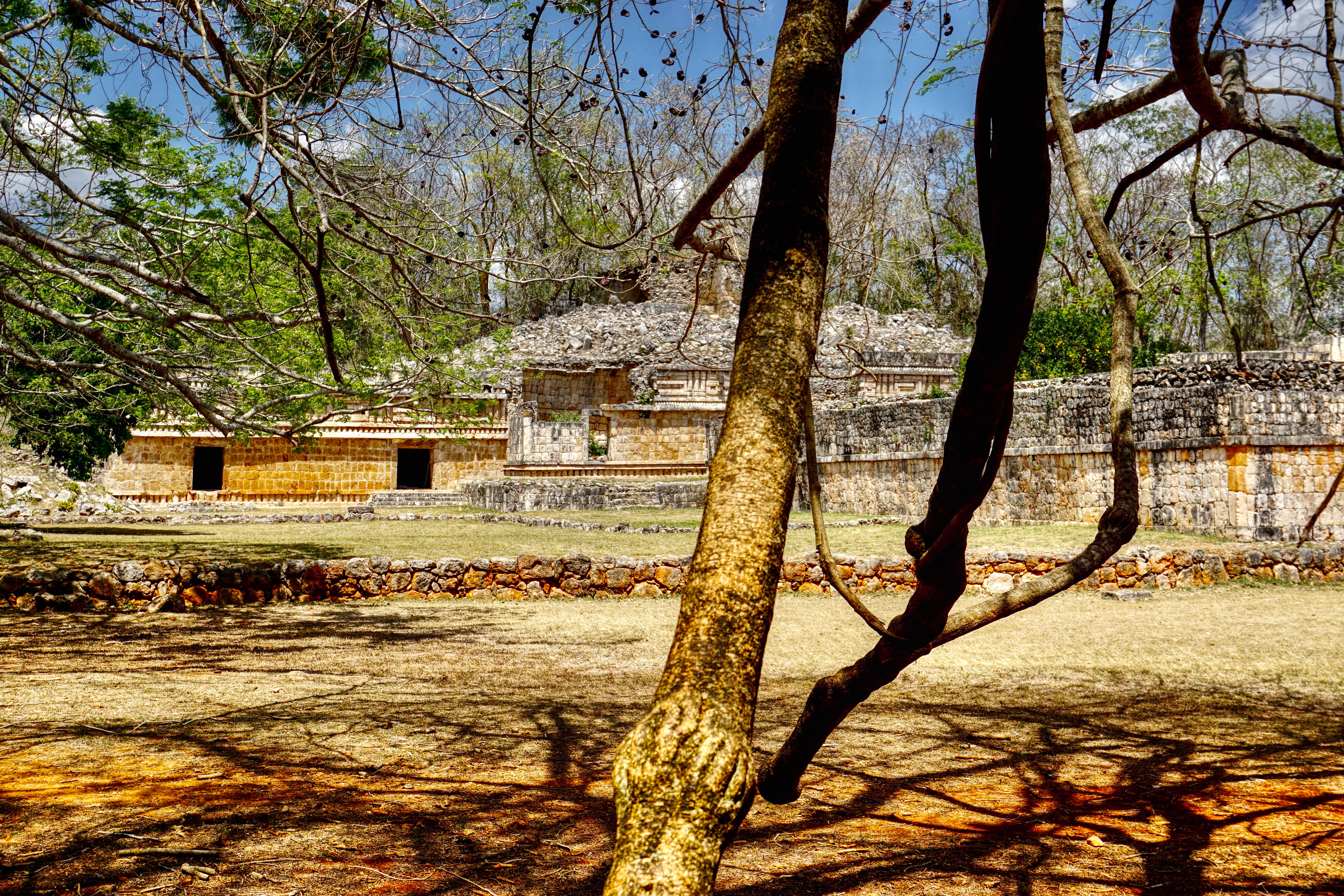
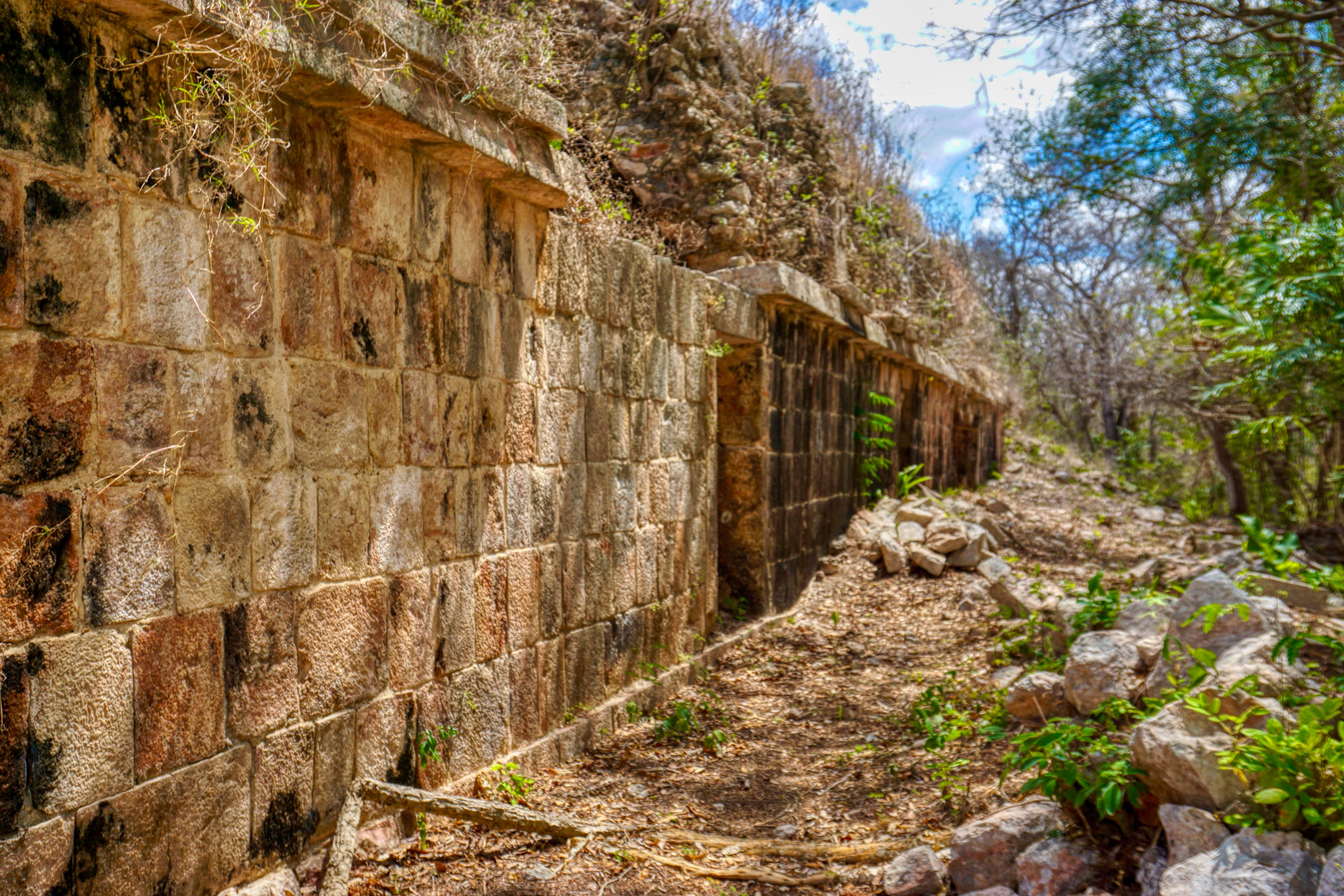
To this day, many of the sites along the Ruta Puuc are, to a large degree, as Stephens and Catherwood would have found them. The temples and pyramids appear out of the jungle like sets from Indiana Jones and the Temple of Doom – jungle vines and palms consume the structures as steps to terraces and pyramids struggle to reveal intricately carved stone patterns, glyphs, human faces and figures, upturned V-shaped arches, gods and warriors including Chac the rain god, whose image is everywhere. They’re still to this day finding lost structures using LiDAR ground penetrating lasers to peer beneath the forest canopy and floor, so who knows just how much is out there left to excavate.
All of these sites are linked though their shared architectural style, referred to as Puuc Style, using a type of core-veneer masonry – building a large solid core which is then adorned with a vivid red façade with other bright colours applied to the stonework. It’s thought that these sites were all connected by slightly elevated white stone roads or Sacbé but as to which of these cities dominated the region is lost to time, though the sheer size of Uxmal must have made it the prime candidate to rule over this part of the Yucatán for centuries.
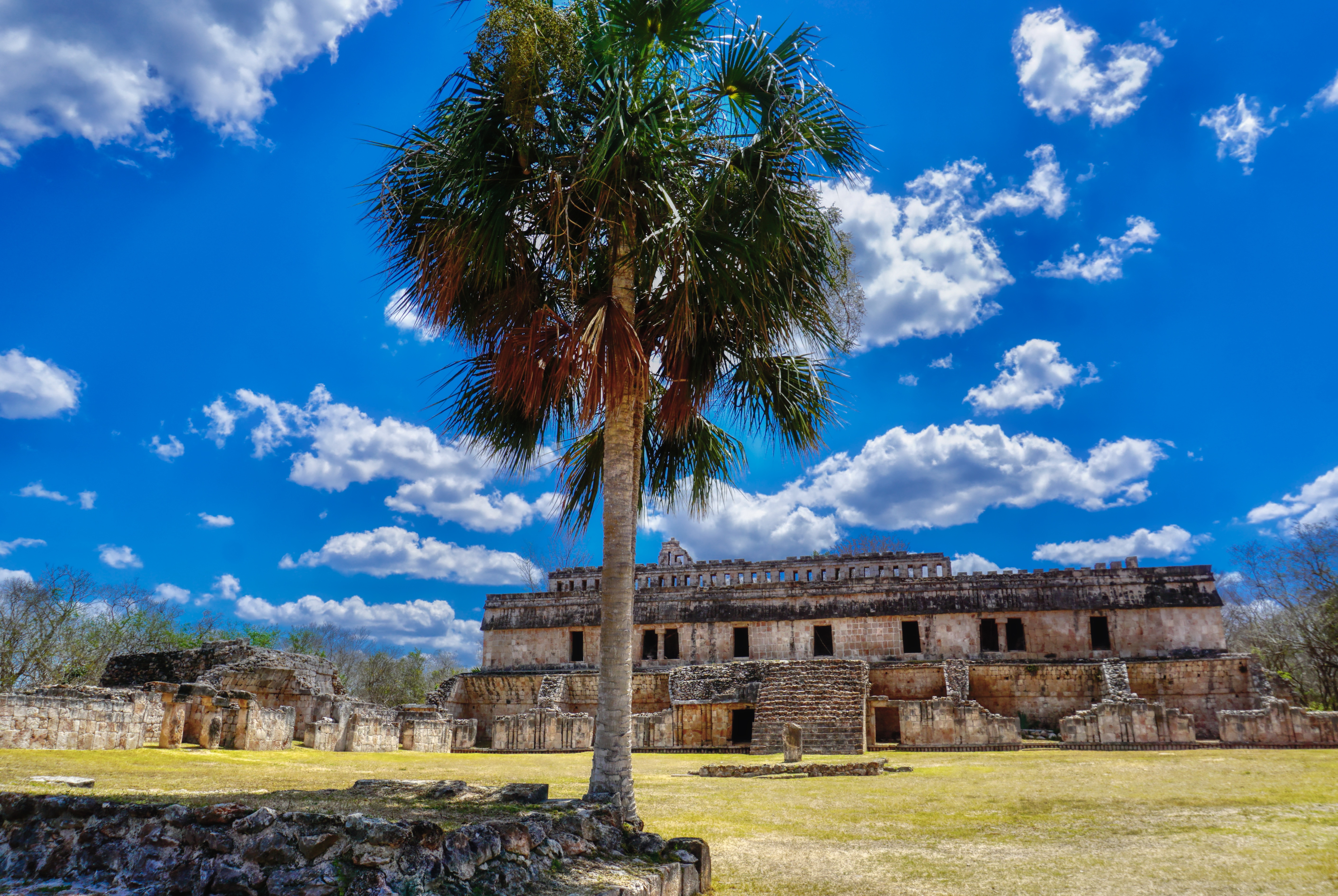
Surprisingly, there’s no one here, no flocks of tourists, just the occasional straggler looking as incredulous as we did. At each site there’s a dusty clearing for cars and a small ‘shack’ with attendant and visitors book to take the 70 pesos entrance fee, a worn map of the site and one or two faded plaques on the history and culture of these places. You’re left to roam at will, clamber over the structures and stare at the truly awe-inspiring grandeur of what the Maya had achieved, long before other civilisations around the world.
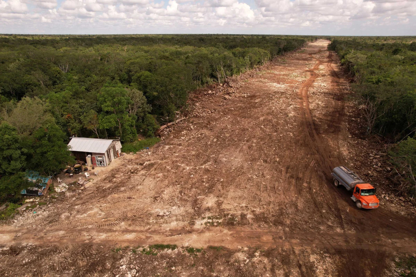
But perhaps all of this is about to change. El Tren Maya is a 1,525-kilometre high-speed tourist railway that is going to traverse the Yucatán Peninsula, connecting the Caribbean fleshpots of Cancún, Playa del Carmen and Tulum with Mérida and Campeche along with the Mayan sites of Chichén Itzá and Izamal and, I’m afraid to say, the Ruta Puuc, so that Uxmal, Kabah, Sayil, Xlapak and Labná will be annexed before the train plunges into neighbouring Campeche and deeper into the jungle interior, skimming past the remote site of Calakmul. There are further plans to extend El Tren Maya into Chiapas and terminate at the remote Mayan city of Palenque. On our drive towards the Ruta Puuc we passed several areas of construction for El Tren Maya, seeing first-hand the impact that this project is already having on the region. It cuts through the jungle in wide straight lines, cutting off communities and inflicting a giant raw scar on the landscape in its determined march forward.
It’s an extremely controversial project in Mexico, and of course amongst the people of the Yucatán, being pushed through by the President, Andrés Manual López Obrador (known here as AMLO). It’s widely considered to be an environmental disaster that will not only destroy indigenous land and livelihoods but threaten the densest parts of the jungle and the already endangered Jaguar populations. The whole Yucatán Peninsula is built on top of an extremely fragile system of caves and cenotes, forming the largest aquifer in the world and the source of drinking water for some 5 million Mexicans, so there’s a lot at stake here. But on it goes… due for completion sometime in 2024. Changing the face of the peninsula forever.
So, we’re very thankful for the chance to see these wonderous sites sitting silent sentinel in the jungle, at this point still lost in time. I wonder if we came back in a year or so just how much things will have changed.

The blight of expanding tourism, one of the most destructive isms of the last half century. I’m sure the sign Jaguar Crossing is not to alert drivers to approaching luxury vehicles. What a shame you did not see a jaguar in the wild.
LikeLiked by 1 person